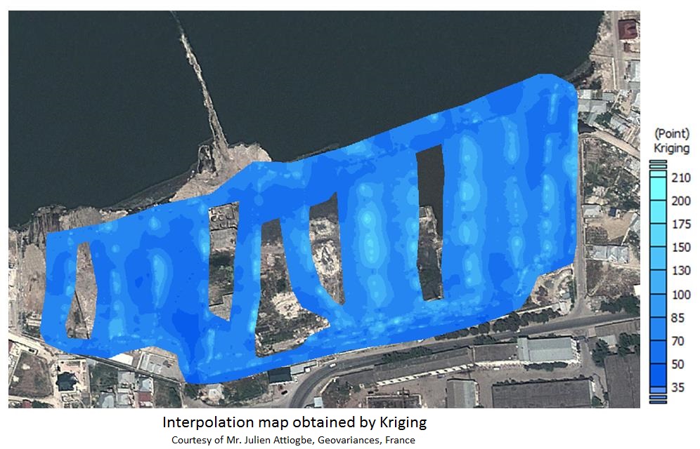
8.2.4.1 Interpolation
A number of simple interpolation methods, such as inverse distance weighting, bilinear interpolation and nearest-neighbour interpolation, are well known. Geostatistical data processing goes beyond the pure deterministic interpolation by considering the studied phenomenon at unknown locations as a set of correlated random variables and taking the spatial structure of the phenomenon (variogram) into account.
Geostatistics based interpretation of results delivers 2D/3D accurate and reliable results. The estimation map is obtained by using ordinary Kriging method (developed to be the best linear and unbiased interpolator). An associated map representing the kriging error variance identifies under-sampled areas that shall require additional sampling in order to reduce the uncertainty arising from the interpolation with insufficient population statistics.