6.2 GPS sensors: resolution, accuracy and costs
The GPS (Global Positioning System) allows anyone with an inexpensive GPS receiver to find their location to within 10–15 m accuracy in coordinates. This extraordinary technology is indispensable to any GIS project in that anyone can "create" their own geographical layers.
There are two groups of GPS instruments: navigation units and data loggers.
Navigation GPS instruments usually cost between US $200 and 1000. They are designed to allow travellers to find their way and not as a means for data collection. Cheaper instruments can usually store a maximum of 500 waypoints, and they record only the waypoint number and its coordinates, with no option to add additional details. More expensive units might have memory for 750 or more waypoints, and an option to enter a short text comment with the waypoint number. Transferring a table of waypoints to a computer and converting to GIS layers usually requires some additional software and will not contain any information other than the waypoint number.
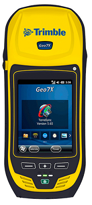
Data logger GPS instruments, on the other hand, contain very sophisticated data design and collection abilities. These instruments often cost upwards of US $4000, but they will have a long lasting rechargeable battery, waterproof case, large internal memory and, most importantly, data handling functions. The instrument will interface smoothly with a PC, allowing easy upload and download of GPS data files, as well as with computer software to convert the GPS files directly into GIS layers. The attribute tables inside the GPS are fully user defined, giving total flexibility in collecting a wealth of information — textual, numerical, menu based — together with the geographical location of features.
A word about accuracy should be added. Today every GPS unit, whether it costs US $100 or US $10 000, can deliver measurements to a precision of at least 15 m. Precision can be brought down to less than 1 m, and even better than that, by utilizing a system called differential correction. This system requires that the GPS be "differential ready", and it will employ a special external antenna which receives correction signals from a base station. Most base stations charge a fee for use of their service.